


BIRNAMWOOD - V1 Voting District, Marathon County, Wisconsin
About
Outline

Summary
| Unique Area Identifier | 694773 |
| Name | BIRNAMWOOD - V1 Voting District |
| County | Marathon County |
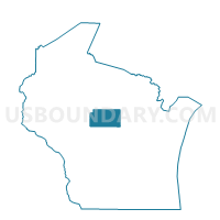
| State | Wisconsin |
| Area (square miles) | 0.06 |
| Land Area (square miles) | 0.06 |
| Water Area (square miles) | 0.00 |
| % of Land Area | 100.00 |
| % of Water Area | 0.00 |
| Latitude of the Internal Point | 44.92659640 |
| Longtitude of the Internal Point | -89.22626370 |
Maps


Graphs
Select a template below for downloading or customizing gragh for BIRNAMWOOD - V1 Voting District, Marathon County, Wisconsin


Neighbors
Neighoring Voting District (by Name) Neighboring Voting District on the Map
- Birnamwood - V 1 Voting District, Shawano County, WI
- NORRIE - T 1 Voting District, Marathon County, WI
Top 10 Neighboring County Subdivision (by Population) Neighboring County Subdivision on the Map
- Norrie town, Marathon County, WI (976)
- Birnamwood village, Shawano County, WI (802)
- Birnamwood village, Marathon County, WI (16)